
Cape Mabou Highlands
Length: 30+km (18.8+mi) total Hiking time: 1-8+hr Type of Trail: natural surface, compacted earth Uses (no snow): walking Uses (snow): snowshoeing Facilities: interpretive panels Dog Use: off-leash permitted Gov’t Topo Map: 11K03 (Lake Ainslie) Rating (1-5): 4 [steepness] Trailhead GPS Reference: N 46 08” 31.6’ W 61 26” 48.2’ Access Information: In the village of Mabou, turn off Highway 19 onto the Mabou Harbour Road. Drive 5 km (3 mi), turning right onto the unpaved Mabou Mines Road. Continue 7 km (4.5 mi) to the bridge at Mill Brook, just past the last house and clearing. Either park here, or continue about 500m/yd on the other side up the deeply rutted small hill and park at the Mabou Post Road Trailhead sign, without blocking the road. Introduction: The Mabou Highlands form a rounded knoll 15 km (9.5 mi) long by 8 km (5 mi) wide reaching an elevation of 335 m (1100 ft) at the north end and 320 m (1050 ft) at the south. Formed of highly erosion-resistant, metamorphosed sedimentary and volcanic rocks, the surface is highly dissected and the sides deeply eroded. Many trails in the Mabou Highlands are quite challenging, requiring strenuous climbs to reach the best viewing sites. These same Mabou Highlands were also once the home of many industrious Scottish families, who cleared the hills and grazed sheep on their grassy slopes. Now, save for a few cottages, the area lies mostly deserted and forest has reclaimed the ravines. The former cart tracks connecting long abandoned farms have become a network of challenging trails, courtesy of the volunteer Cape Mabou Trail Club. By 1998, twelve different trails totalling more than 30 km (18.75 mi) of maintained paths were available. Cautionary Notes: Wildlife. Hunting permitted. Steep climbs. Motorized vehicles in some sections. Poison Ivy. Cell Phone reception is generally available at higher elevations. No reception ravines, under thick foliage, and on most inland sections. Ratings are designated from 1 to 5 indicating suitability for all fitness and experience levels, with 5 being suitable only for experienced and very fit outdoor people. Novices should only choose level 1 and 2 hikes, and work their way up. Level 4 and 5 hikes have indicators associated with their ratings.
Share a star rating, a quick note, and a photo or two to help future travellers.
Sign in to write a reviewVisitor photos
Sign in to add a photoLoading photos…
You might also like

Alexander Graham Bell National Historic Site
Be inspired by the fascinating life and work of Alexander Graham Bell – inventor, scientist, teacher, and devoted family
★★★★★ (2486)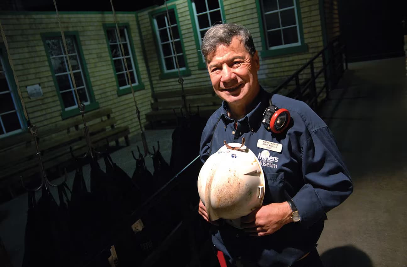
Cape Breton Miners Museum – A day in the life of a Cape Breton coal miner
Take an immersive virtual mine tour through the last century of coal mining in Cape Breton. Then journey into the depths
★★★★★ (903)
Cape Breton Miners Museum
The Cape Breton Miners’ Museum in Glace Bay pays tribute to the contribution of the region’s coal miners and coal mining
★★★★★ (903)